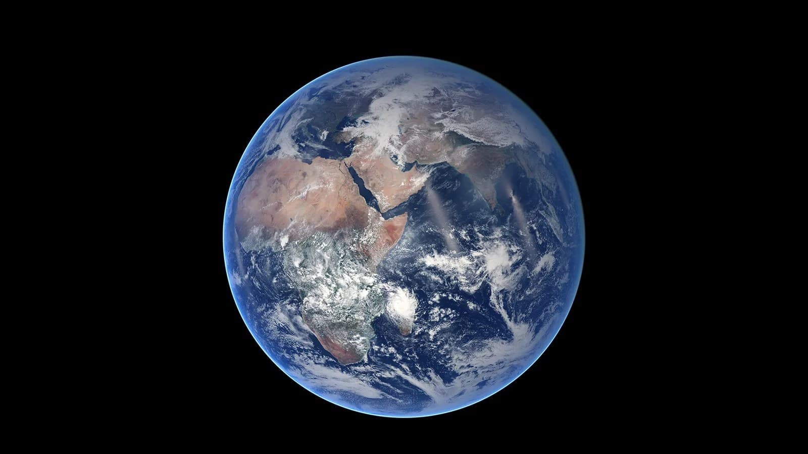
Oceans, air and a living surface
Earth is the only world where life has been confirmed by observation. Oceans cover most of its surface, the atmosphere transports heat, and plate tectonics reshapes the continents. A photograph from space shows only the outer shell of this complex system.
Earth: key facts
- Type
- Rocky planet
- Mean radius
- 6,371 km
- Mean distance from the Sun
- ≈ 1 AU · 150 million km
- Orbital period
- ≈ 365.26 Earth days
- Rotation
- 23 h 56 min · sidereal
- Temperature
- ≈ +15 °C · average
- Mass
- 5,97 × 10²⁴ kg
- Mean density
- 5 514 kg/m³
Values are rounded. The distance describes the orbit, not the current distance from Earth. For giant planets, temperature refers to a reference atmospheric level: they have no solid ground. Mean radius differs from equatorial radius.
Atmosphere and appearance
About 78% nitrogen, 21% oxygen and 1% other gases. Air scatters sunlight, creating a blue sky.
Oceans
Water covers about 71% of the surface.
Plate motion
The crust and uppermost mantle form the moving lithosphere.
Magnetic field
Motion in the liquid metallic core generates a magnetic field.
What is inside?
Scientific model. Layer colors are illustrative; the thin crust is enlarged for clarity.
Crust
A thin outer shell, thinner beneath oceans than beneath continents.
Mantle
Hot, mostly solid rock flows slowly over geological timescales.
Outer core
Liquid iron and nickel. Motion in the metal is associated with the magnetic field.
Inner core
A solid iron-nickel core with a radius of about 1,221 km.
The cutaway is based on physical models and indirect measurements. It is not a photograph of the interior; in 3D, you can select each layer separately.
Natural satellites
The Moon is Earth's only natural satellite. Its average distance is about 384,400 km; the actual distance varies along its elliptical orbit.
History of discovery and exploration
Our home world
Earth was never discovered as a distant planet. Our understanding of its place in space changed; the view from space first allowed us to observe the whole world as a single system.
- 1543
Earth among the planets
Copernicus published a model in which Earth and the other planets orbit the Sun.
- 1958
Radiation belts
Explorer 1 data helped reveal the Van Allen belts, regions of charged particles trapped by Earth's magnetic field.
- December 24, 1968
Earthrise
During Apollo 8, Bill Anders photographed Earth above the lunar horizon. The view became one of the defining images of the space age.
- July 23, 1972
The beginning of Landsat
Landsat 1 launched. The NASA and USGS program established a long record of land observations, allowing scientists to study changes to the planet.
NASA satellite observations measure clouds, oceans, ice and changes to the surface.
What an Earth portrait from space reveals
A full Earth disk combines the surface, cloud cover and the atmosphere’s bright limb. They are not one fixed pattern: clouds change quickly, while continental shapes persist over vastly longer intervals. Date, illumination and camera position affect how much land and ocean are visible. Two genuine frames of the same planet can therefore differ greatly without implying that its geography changed within a few hours.
Detailed satellite maps often combine many observations rather than one instantaneous photograph. This can reduce cloud obstruction or compare a selected variable across the planet. A mosaic remains measurement-based, but its dates and assembly method matter. Distinguish photographic views from thematic maps: colours representing temperature, vegetation or elevation need not match a landscape’s ordinary appearance.
Even at a space station’s altitude, the atmosphere still affects flight: faint drag gradually lowers the orbit without corrective manoeuvres. This physics also matters for the future of the ISS: ending station operations and safely guiding its structure into the atmosphere are separate tasks. A view of Earth from space does not mean the spacecraft has entirely escaped its gaseous envelope.
Weather and climate need different timescales
One atmospheric swirl in a photograph shows a weather situation, not a complete climate description. Climate studies compare statistics and changes over long periods using many observations. A warm day at one site does not measure the whole planet, just as a cold week does not overturn a long-term trend. Remember this distinction when an attractive single frame accompanies an overly broad claim about Earth’s condition.
Before comparing two periods yourself, check that season, region and measurement method match. Winter snow and summer greenery are expected and do not alone demonstrate a long-term change. Read the units and scale on thematic maps: the same shade in different palettes may represent different values. Careful comparison begins with a question and suitable data, not with selecting the most expressive picture.
Water connects ocean, air and land
The water cycle links evaporation, moisture transport, cloud formation, precipitation and movement above and below ground. It involves more than a textbook droplet’s journey: energy is redistributed with moisture. Ocean and atmosphere are therefore not independent decorations around a rocky planet. Changes in one part can influence others, making observations at several levels necessary.
Earth’s abundant water does not make freshwater equally available in every region. Its storage location, movement rate and physical state matter. A satellite image of a river gives spatial information but cannot replace measurements of flow or water quality. Likewise, a blue full disk does not summarise every ocean property in one number: different questions require different instruments and time series.
Earth as a reference for studying other worlds
Earth offers a rare chance to compare a distant planetary view with direct surface measurements. Researchers can test how clouds hide oceans, how reflected light changes and which atmospheric features instruments detect. This experience informs questions about exoplanets. Yet similarity in one spectral feature does not make a distant world an Earth copy: multiple explanations for a signal must be considered.
An Earth cutaway and an external photograph represent different kinds of knowledge. Interior boundaries are inferred from observations and physical constraints; an orbital camera does not look through the crust to the core. Use a cutaway to understand relationships between layers, not as a picture of an actually opened planet. In comparisons with other rocky worlds, distinguish directly measured parameters from model-dependent conclusions.
Questions and answers
What is Earth's atmosphere made of?
Near the surface, dry air contains about 78% nitrogen and 21% oxygen, with argon and other gases making up the rest. The amount of water vapor varies and is not included in these dry-air proportions.
Is Earth's mantle liquid?
Most of the mantle is solid rock that can deform slowly over geological timescales. The liquid outer core and localized molten regions must not be taken to represent the whole mantle.
Why does the Moon always show almost the same side?
Its rotation is synchronized with its orbit around Earth. Small changes in viewing angle, called librations, let us see slightly more than half of the lunar surface over time.
Continue exploring
The model offers a cutaway, rotation, images and a walk across reconstructed terrain. You can read the information on this page without loading 3D.
Open in the journeyAll planets and the SunSources and image
- NASA: object overview
- Exploration history · www.nasa.gov
- Exploration history · www.jpl.nasa.gov
- Exploration history · www.nasa.gov
- Exploration history · science.nasa.gov
- Exploration history · science.nasa.gov
- Exploration history · earthobservatory.nasa.gov
- Exploration history · science.nasa.gov
- Exploration history · www.nasa.gov
- NASA: physical parameters
- USGS: Earth's solid mantle