How to identify a constellation: two different methods
If you already have a photograph of the starry sky, you need an astrometric solving service: it matches the star pattern against a catalog and determines the image's position. Astrometry.net accepts these images and returns information about the region of sky and known objects within it. You will find a link to the service at the bottom of this page.
If you are standing under the sky with your phone, a map that uses your location, the time, and the device's direction is more convenient. In COSMO360's Sky section, the camera provides a background for the calculated map. There is no option to upload existing photos there. Your choice depends on the task: understanding yesterday's photo or finding out where you are looking now.
What the service looks for in a photo
Astrometric calibration is often called plate solving. The program identifies light sources and compares the geometry of groups of stars against prepared catalogs. If a match passes verification, the image's direction, scale, and rotation become known. This is a more precisely defined task than searching the internet for a similar picture.
The paper by the creators of Astrometry.net describes matching stellar configurations without knowing in advance where an image points. That does not mean it can process every phone photo. One bright spot provides too few reference points for reliable matching: recognizable stars are needed around it. Blurring, overexposure, and a sparse star field make it harder to find a suitable configuration.
Prepare an image of the stars
Choose an original image showing several separate stars, rather than just one bright object. For your first attempt, preserving the surrounding star field is more useful than cutting out a small area around a suspected star. A compressed image from a messaging app may lose faint points, so start with the original if you have it.
Check that reflections from streetlights or marks on glass have not been mistaken for stars. A practical reference is the consistent pattern of several points, rather than the impressive brightness of one. Keep an untouched copy of the file for comparison: you will need to check the result's labels against the original arrangement of stars, rather than simply reading the name of the most obvious object.
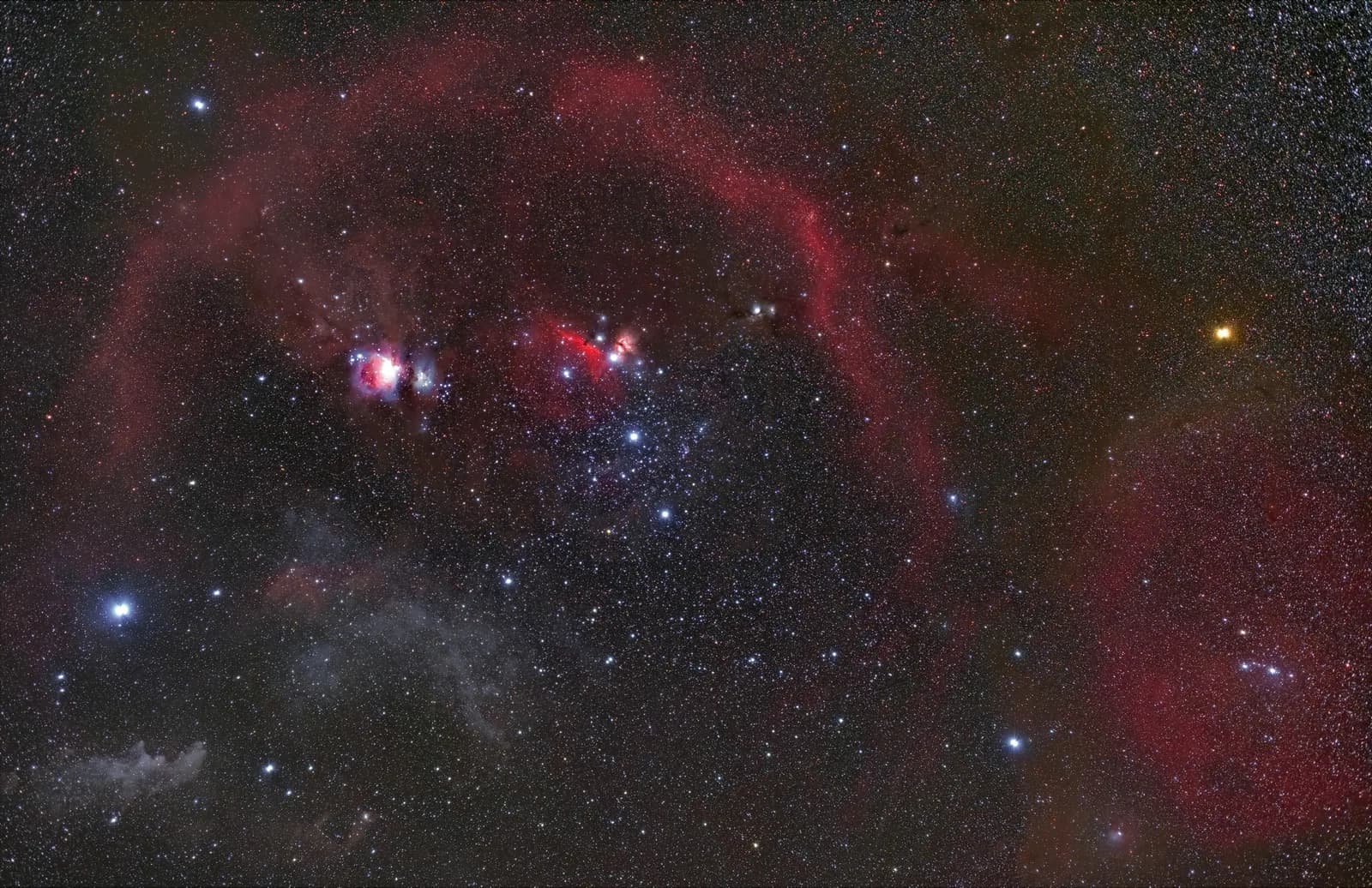
For an initial check, try a photograph of Orion: its three Belt stars provide a recognizable reference. If faint points disappear in city light, consult a light pollution map before taking another photograph and choose a darker location.
How to identify a constellation from a photo online
First, follow the link from Astrometry.net's usage page to the Nova web service. Choose the image-upload option and your prepared file. Interface labels and sign-in requirements can change, so follow the service's current form. Remember that you are sending the image to an external website for processing, rather than uploading it to COSMO360.
Second, wait for the image to be processed. If a solution is found, open the information about the identified region and the labeled image. Compare several labeled stars with the original, checking their relative positions and the overall rotation. Save the region's name and the result for further study. If no solution is found, try another original image with a clearer star field; that is more useful than guessing a constellation from a single point.
What to check before uploading a photograph
Before uploading, review the image's visibility and usage settings. Astrometry.net's documentation provides separate settings for public visibility, commercial use, and permission to make modifications. This does not mean that every file will automatically remain private: check the terms of the specific form through which you submit your image.
Choose a photograph you have the right to use. If it includes people, private property, or information you did not intend to publish, first decide whether uploading it externally is appropriate. Sending a file to a server and viewing a local map are different actions. The project also offers installable software for use without an external web service, but setting it up requires a separate study of the documentation.
Why one image can contain several constellations
In modern astronomy, a constellation is a region of the celestial sphere with defined boundaries. The International Astronomical Union recognizes 88 such regions. Lines connecting bright stars help us navigate, but they do not define the entire area of a constellation. Different maps may connect the stars in slightly different ways.
A wide photograph therefore does not necessarily belong to a single constellation. An identified object may be near the edge of the frame, while the center lies in a neighboring region. Compare several labels against an atlas and check how much of the sky the image covers. Do not treat the first name in the result as the answer for the whole picture: it is more accurate to say which regions and landmarks are actually in the frame.
How to identify a constellation by pointing your phone at the sky
In COSMO360, open the sky map and confirm your location: use geolocation, select a city, or enter coordinates manually. Check your device's time. Once explicitly started, the camera shows the surrounding sky, while sensors help calculate where the phone is pointing. Your browser may request access to the camera and orientation data.
First, find a familiar bright landmark on the screen and compare it with the sky, then explore the neighboring star labels. This is guidance based on the device's direction: the video image is not compared against a catalog, and the phone does not extract stars from the image. If the camera or sensors are unavailable, open the manual map, choose your location by city, and move the view yourself. This mode does not require a camera or motion sensors.
A planetarium is useful without a photograph too: it can recreate a birth-date star map or the sky at another memorable event. That needs a location and time rather than the direction your phone faces now. Make sure you have selected the historical moment, or the app will show today’s sky instead of the scene you want.
Why labels may not line up with the sky
A digital compass is sensitive to its surroundings. Apple warns that electromagnetic interference affects its accuracy, so its readings should be used as an aid. If the map is noticeably offset, move away from cars and other possible sources of interference, check the location and time again, and then compare several landmarks.
Do not force an identification to fit a single bright point: an incorrect direction can produce a convincing but wrong label. If you cannot align the map with the sky, use manual mode to learn where objects are located. For a photo you have already taken, return to astrometric analysis. A verifiable match between several stars is more useful than a confident name without supporting evidence.
Sources
- Astrometry.net: the service's purpose and astrometric calibration results
- Astrometry.net: the Nova web service and local installation
- Astrometry.net: documentation on uploads, visibility, licensing, and results
- Lang et al.: Astrometry.net: Blind astrometric calibration of arbitrary astronomical images
- W3C: Device Orientation and Motion: device orientation and permissions
- Apple: using the compass on iPhone and its accuracy limitations
- IAU: the boundaries of the 88 constellations and the difference between regions and star patterns
- Tool: analyze a star photograph in Nova Astrometry.net
- Stellarium: user guide
Questions and answers
Can a constellation be identified from a photograph online?
Yes, if the image contains enough distinguishable stars to match against a catalog. Astrometry.net identifies the region in the frame and known objects within it. Success is not guaranteed for every image.
Does COSMO360 recognize stars in an uploaded photograph?
No. The Sky section calculates a map from your location, the time, and your phone's direction. The camera provides the background. Use a separate astrometric service to analyze an existing image.
Can you identify a constellation from just one star?
That conclusion is unreliable without additional reference points. You need neighboring stars or information about your location, the time, and viewing direction. One bright point alone does not confirm the name of the region.
Do I have to allow location and camera access?
To explore the COSMO360 map manually, you can select a city and use it without a camera or sensors. Automatic pointing requires a suitable device and permissions. This is separate from uploading a photograph to an external service.